Garmin echoMAP Marine Chartplotter - Flush Mount, Bail Mount
On back-order, will ship once in-stock
- All Locations: (0+)
| Manufacturer | Garmin, Ltd |
| Manufacturer Part Number | 010-02880-00 |
| Brand Name | Garmin |
| Product Line | echoMAP |
| Product Name | echoMAP Marine Chartplotter |
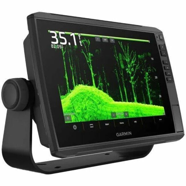
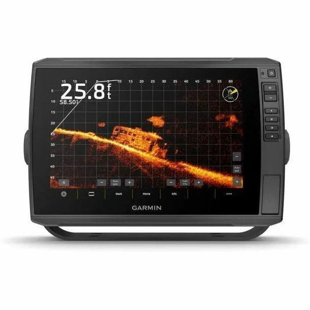
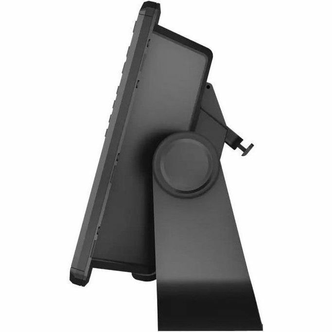
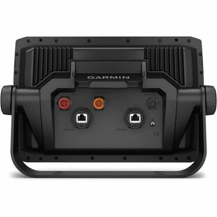
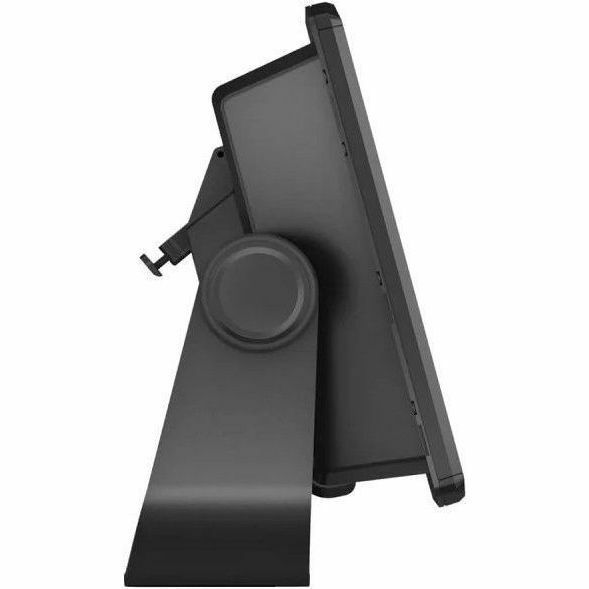
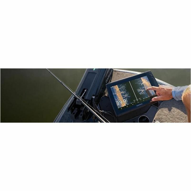
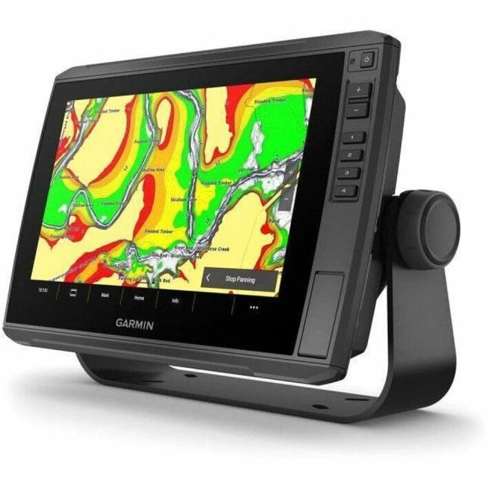
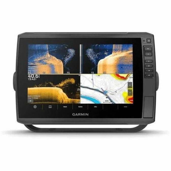
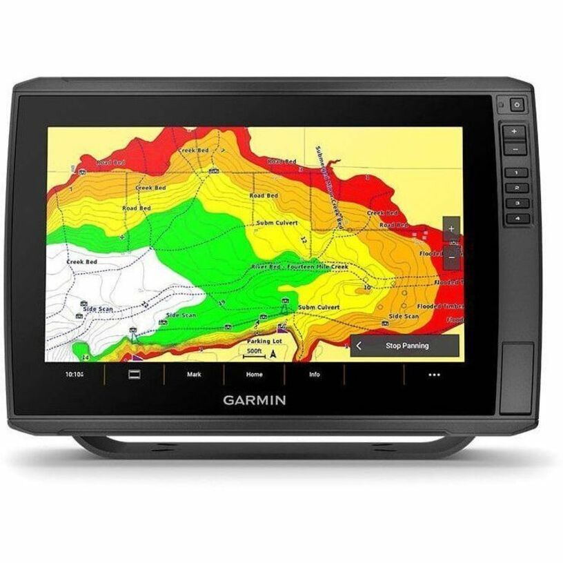
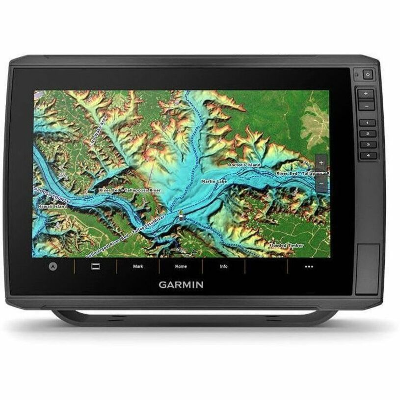
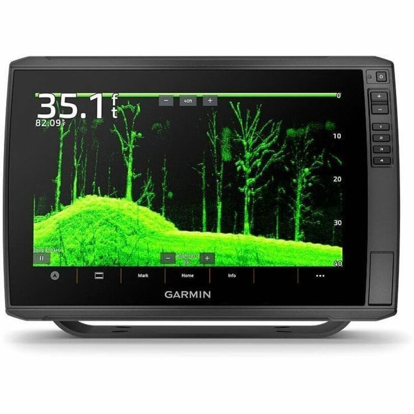
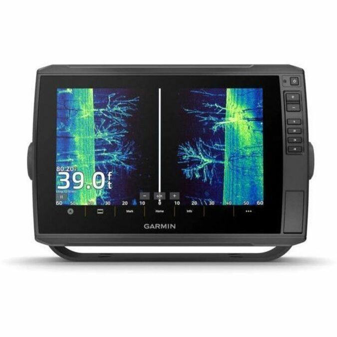
| Marketing Information | ALL THE TOOLS YOU NEED FOR SUCCESSFUL FISHING With big, crisp, sunlight-readable touchscreen displays, these versatile chartplotters put a world of fishfinding capability at your fingertips. They're available with built-in Garmin Navionics+™ mapping, and the transducer bundle adds Ultra High-Definition scanning sonars as well as CHIRP traditional sonar. 10" OR 12" TOUCHSCREENS SUPPORTS LIVESCOPE™ SONAR AND MORE AVAILABLE WITH BUILT-IN GARMIN NAVIONICS+ MAPPING WIRELESSLY NETWORK; SHARE SONAR, WAYPOINTS AND ROUTES CAPTURE SCREEN RECORDINGS TO SHARE FISH CATCHES MULTI-BAND GPS FOR IMPROVED POSITION ACCURACY WHAT YOU'LL LOVE | LIVESCOPE™ SONAR SUPPORT The ECHOMAP Ultra 2 series supports the full lineup of LiveScope live-scanning sonar products (transducers sold separately). BUILT-IN UHD SONAR Select models are bundled with a GT56 transducer which provides Garmin CHIRP traditional sonar and Ultra High-Definition ClearVü™ and SideVü™ scanning sonars for photo-like images of what's beneath the surface. VIVID COLOR PALETTES High-contrast vivid scanning sonar color palettes make it easier than ever to distinguish targets and structure. PRELOADED CHARTS Experience unparalleled coverage and detail. Select units come with built-in Garmin Navionics+ mapping, which includes a 1-year subscription for daily updates, depth range shading and more. PREMIUM MAP UPGRADES Bring a fresh new look and feel to your chartplotter with optional Garmin Navionics Vision+ ™ premium mapping (sold separately), featuring high-resolution relief shading, satellite imagery and more. WIRELESS NETWORKING If you have another compatible ECHOMAP Ultra 2 or ECHOMAP UHD2 chartplotter on your boat, you can wirelessly share information - such as sonar, waypoints and routes - with them. See everything with the ultra high-definition scanning sonar system. STAY CONNECTED | MULTI-BAND GPS Get improved position accuracy with multi-band GPS NMEA 2000® NETWORK COMPATIBILITY Connect to heading sensors, autopilots, Fusion-Link™ audio systems and more. ACTIVECAPTAIN® APP Pair with the free smart-device app for software updates, screen recording, Garmin Quickdraw™ Community data and more4. FORCE® TROLLING MOTOR Wirelessly connect to your Force trolling motor to navigate to waypoints, draw and follow routes, and more. TAKE IT WITH YOU The quick-disconnect bail mount lets you quickly install and remove your unit. |
| Product Type | Marine Chartplotter |
| Built-in Devices | Sonar Detector |
| Application/Usage | Marine |
| Ingress Protection (IP) Rating | IPX7 |
| Preloaded Maps | Yes |
| Screen Size | 10" |
| Graphic Mode | WXGA |
| Display Resolution | 1280 x 800 |
| Touchscreen | Yes |
| Display Screen Type | Touchscreen |
| Durability | Water Proof |
| Form Factor |
|
| Height | 3.90" (99.06 mm) |
| Width | 7.70" (195.58 mm) |
| Depth | 11.60" (294.64 mm) |
| Weight (Approximate) | 4 lb (1814.37 g) |
| Package Contents |
|
| Condition | No |
| UPC | 753759325510 |